Site Report 3: An Audio Tour
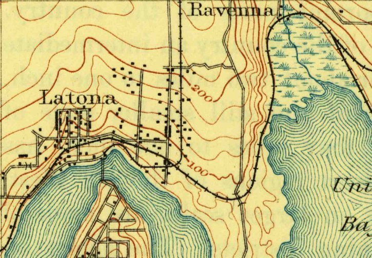
Figure 1: A U.S. Geological Survey showing the first developments in the U District. U.S. Geological Survey, Seattle. USGS Historical Files Topographic Division. Created December, 1984
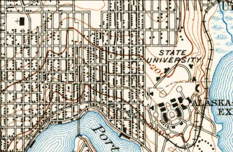
Figure 2: A United States Department of Interior Geological Survey that shows the further development of the U District including streets, bridges, and the UW campus. Created by J.G Hefty; C.F Eberly. USGS Historical Files Topographic Division. 1908.
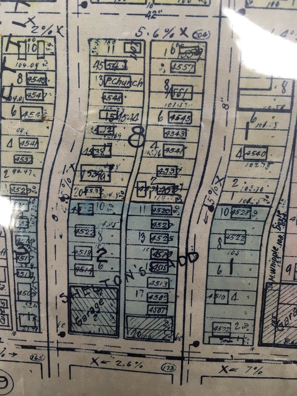
Figure 3: A map that shows the developments on my block. Created by Kroll Map Co. University of Washington Libraries, Special Collections Division (Seattle, WA). 1920.
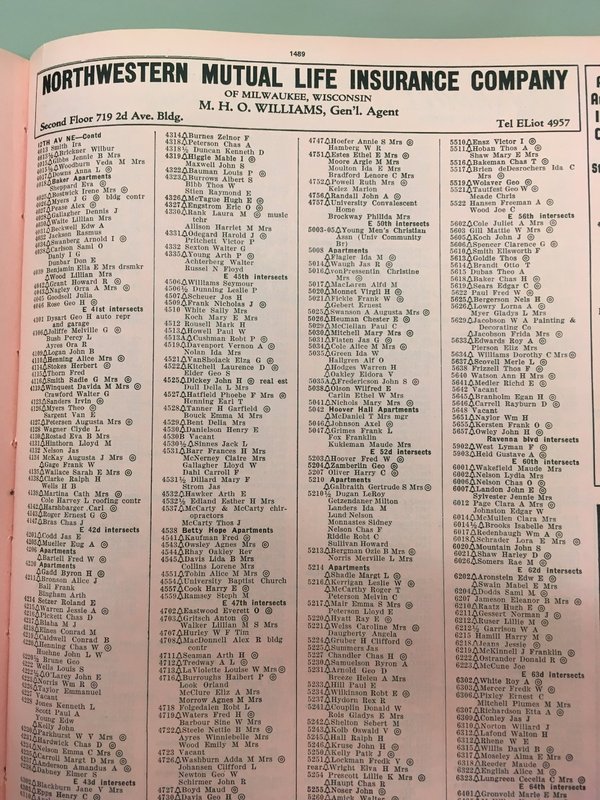
Figure 4: The city directory that shows the homeowners and businesses residing on my block. Created by R. L. Polk & CO.University of Washington Libraries, Special Collections Division (Seattle, WA). 1942.
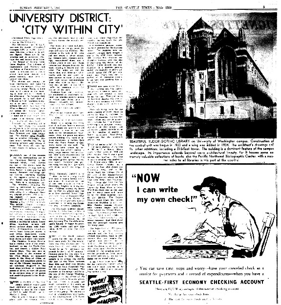
A news article that reveals the community dynamics of the district. Seattle Times Company. University of Washington Libraries (Seattle, WA). 1946.
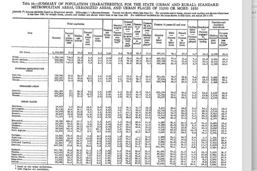
Figure 5: A table created to show a summary of the population in Washington. Created by the Bureau of the Census. United States Department of Commerce. 1943.
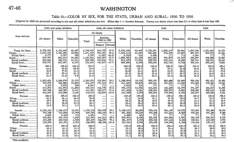
Figure 5.1: A table created to show a summary of the population demographics in Washington. Created by the Bureau of the Census. United States Department of Commerce. 1943.
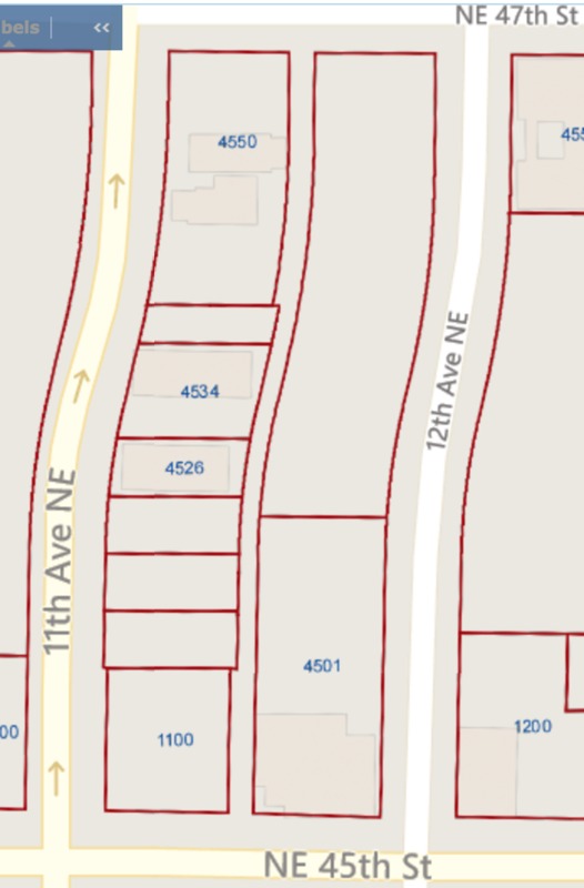
Figure 6: An image showing the current lots on my block. Seattle Department of Constructions and Inspections. 2007.
The first settlements of the University District were just north of Lake Union. In 1894, there were a few buildings and a road or two in the southern area of the district (Figure 1). However, my block was unconstructed at the time. My block wasn’t erected until 1908, when the entire district's road and block system was implemented (Figure 2). In 1920, my block was divided into 2 by 20 lots, for a total of 40. These lots were either vacant, had small buildings—most likely houses—or was a garage. Further examination of the atlas (Figure 3), shows a difference in color of my block which signifies whom owned the land. It seems that someone named Shelton owned the lower half of my blocks lots—closer to 45thSt—as well as the two adjacent blocks. By 1942, my block was completely full, with 38 homeowners, 2 businesses, a parking garage, and an apartment complex (Figure 4). The two businesses were McCarty & McCarty Chiropractors and Dickey John H Real Estate. Based on newspapers records, it appears that majority of my block was residential and consisted of families that would host parties and dinners. During the 1940’s, the U District was the ideal location to raise a family with its abundant restaurants, shops, churches, and schools. The area was majorly white and had the largest urban population in the state (Figure 5, 5.1). However, as the years passed, the U District began to deteriorate. Since most of the construction in the U District occurred between 1909 and 1930, the buildings were beginning to wear down. My block lost a majority of its buildings. As of 2007, there were only five structures on my block and 10 lots compared to the 40 lots in 1920 (Figure 6). Because of this deterioration, my block has undergone massive renovations. There are currently 4 new buildings which are used for residential and retail purposes as well as two decrepit buildings that will be demolished. This structural shift mirrors the urban development movement in the District with newer buildings being constructed every year.