Site Report 2

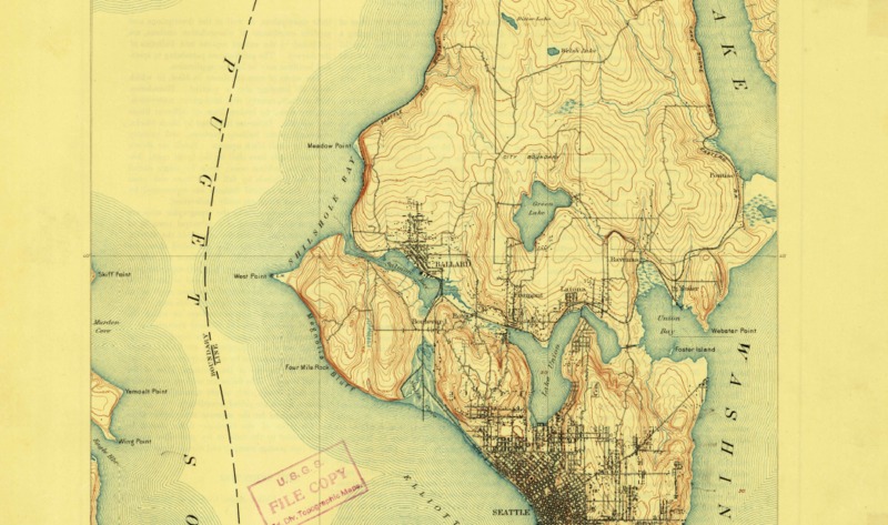
Topography of Seattle Area- 1894
Map of Seattle, Washington from 1894, selected from the USGS topographic map collection. Near the South East corner of Green Lake lies my block. As seen in the map, the land rises into a small hill.

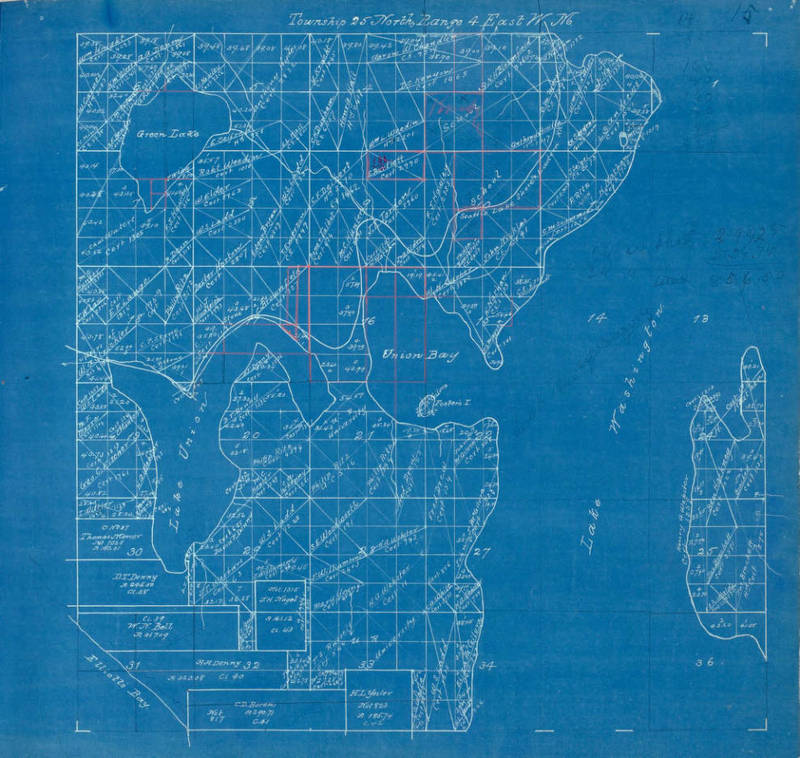
1889 Atlas - King Co., WA
Map of Townships Plats of King County, Washington Territory, by Oliver P. Anderson & Co. (1889). My block sits on the right two boxes of the 8th coordinate. If looked at closer, you can see the owner of the land.

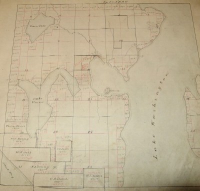
1861-1882 Donation Land Claims
Donation Land Claims map of King County (1882).
Block 69 lies at the North East corner of the 8th quadrant. Here you can see a small stream that used to run through the top right corner.
From the mid 1850’s to now, the topography of my block has changed quite substantially. However, it has not changed nearly as much as the other areas surrounding it. From the first map I discovered, I found that there were only trees/forest areas present. Along with the undeveloped land, a small stream ran through the North East corner (Series). The elevation of my block was higher than the surrounding land. From the topography maps found in the 1860’s, it looks as though block 69 sat near the top of a small hill (Seattle). However, this is not the case now as seen through current photos of the residential area. On 9th, the street of my block seems to dip somewhat, so it is clear to see whatever elevation was there before, has been altered completely. However, before you proceed to dip down, you can see from the current photo, that a subtle elevation still remains of how the area used to keep rising to form a small hill. You can also observe the large evergreens that tower over before the start of the street. These evergreens are representative of the forest that existed at my block before development. The land looked to have been un-owned/undeveloped until the year 1889. As seen through the Washington Territory map, my block finally had an owner by this time. This area and the surrounding land was owned by a Edgar Bryan W.S. Ladd (Anderson). The stream was still present during this time period.
From these maps it is also apparent the manipulation of the waterscape. For instance, comparing from the 1890’s to today, Green Lake had a larger circumference (Seattle). Lake union was also greatly manipulated as well. Union Bay and Lake Union had once been two separate bodies of water, however in 1911, the state of Washington began the construction of the Lake Washington Ship Canal. This Canal was finished in 1934 and runs through 7 bodies of water including Lake Union and Union Bay in order to connect Lake Washington to The Puget Sound (Ship).
As seen in current photos of my block, the land is no longer elevated and actually slopes downwards after a brief rise from the original hill. There is no evidence of any water ways in my area, therefore the stream was altered and either moved or completely blocked off. However, I suspect that the stream was run underground. By the early 1900’s, my block began its development into the residential area it is today with no near surrounding areas left untouched.
